01
Site reconnaissance and survey planning
Reviewed the proposed jetty location, site access, shoreline conditions and survey requirements to plan land- and water-based data collection.
How Skymap Africa integrated single-beam echo sounder (SBES) depth measurements, a remote-controlled survey boat and GNSS RTK topographical surveying to map the shoreline and lakebed for a proposed jetty at Rubi Ranch Lake House.
A reliable jetty design starts with understanding both sides of the waterline.
Skymap Africa was engaged by Rubi Ranch Lake House to undertake a combined topographical and hydrographic survey at Lake Naivasha, Nakuru County. The objective was to provide a consistent picture of the landward shoreline and submerged lakebed around the proposed jetty alignment.
Rather than treating the land and water measurements as separate datasets, our team coordinated GNSS RTK ground observations with sonar depth soundings. The datasets were processed and referenced to create an integrated elevation model for engineering interpretation.
This approach helps project teams assess shoreline levels, underwater gradients and the relationship between the proposed structure and the lakebed.
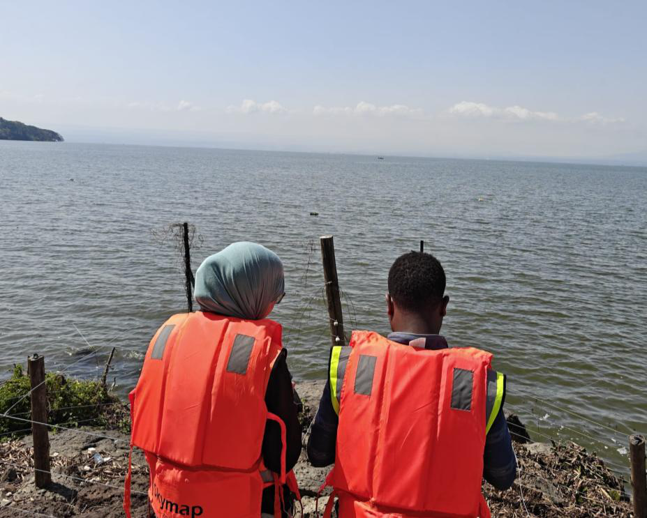
Skymap Africa combined shoreline control, sonar acquisition and geospatial processing to develop useful underwater and land elevation information.
Reviewed the proposed jetty location, site access, shoreline conditions and survey requirements to plan land- and water-based data collection.
A CHCNAV multi-constellation GNSS receiver, used with the MUYA CORS network, captured shoreline topography and relevant terrain features.
A calibrated Chirp single-beam echo sounder mounted on a remote-controlled survey boat recorded water depths along planned survey lines, synchronised with GNSS positions.
Ground survey observations and sonar records were checked, synchronised and reconciled to produce an integrated representation of the shoreline and lakebed.
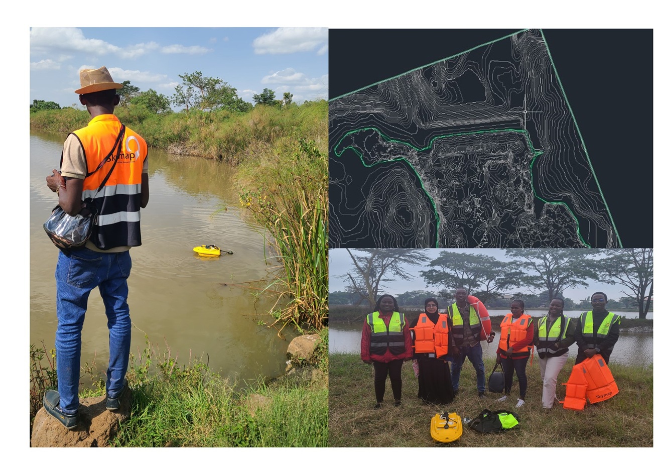
The processed information provides a practical spatial reference for interpreting the lakebed, shoreline transition and proposed jetty alignment.
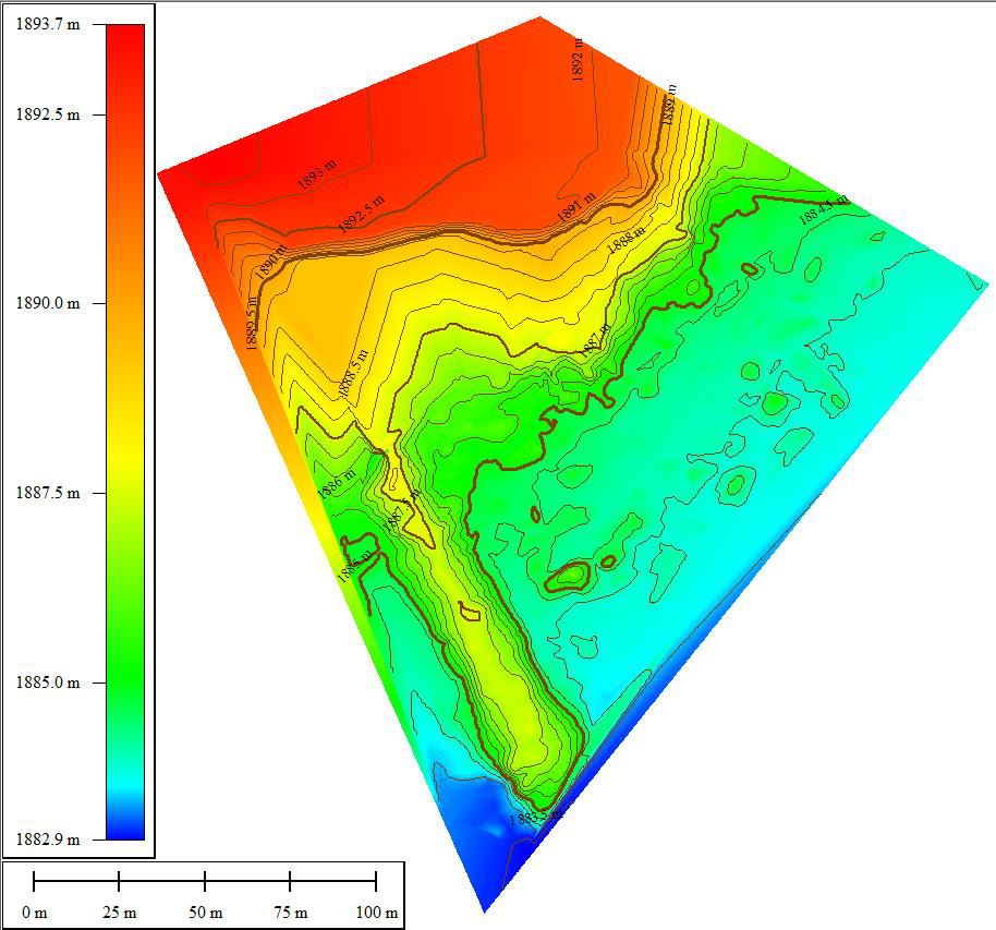
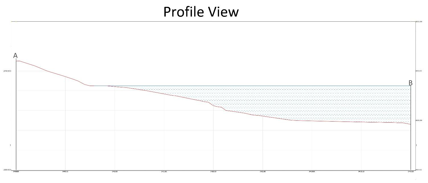
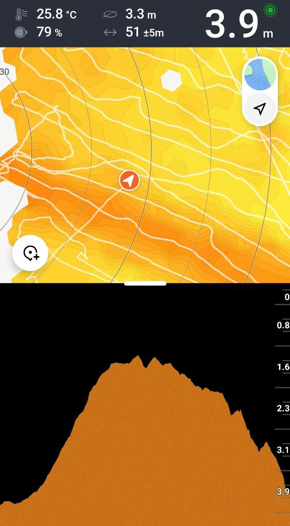
Deliverables are tailored to the project brief and may include the following engineering and geospatial outputs.
Combined mapping of surveyed land and underwater terrain in a coordinated layout.
Depth contours that communicate lakebed shape, gradients and depth variation.
Profiles extracted from the integrated terrain model to support assessment of a proposed jetty alignment.
Digital survey drawings and PDF plots for common CAD-based engineering workflows.
A connected representation of shoreline topography and underwater terrain for engineering interpretation.
Ground observations tied to the project coordinate reference approach for a consistent landward baseline.
Skymap Africa supports engineering, water-resource and infrastructure projects with hydrographic data collection and integrated geospatial survey solutions.
Underwater depth measurement and submerged terrain mapping for inland water bodies.
Hydrographic information to support marine infrastructure planning and construction.
Repeat survey data to help assess changes in bed levels and water storage capacity.
Review project objectives, site access, shoreline conditions and survey limits.
Measure shoreline terrain with GNSS RTK and submerged depths with sonar.
Process and coordinate terrestrial and hydrographic datasets into one model.
Produce maps, profiles and digital files for engineering interpretation.
A bathymetric survey measures water depths and maps the shape, elevations and contours of submerged terrain such as a lakebed, riverbed, reservoir bed or seabed.
Combining underwater depth measurements with shoreline and land elevations creates a connected site model. This helps engineers understand the relationship between the waterbody, shore and proposed infrastructure.
The project used a calibrated Chirp single-beam echo sounder mounted on a remote-controlled survey boat, together with a CHCNAV multi-constellation GNSS receiver and the MUYA CORS network for shoreline surveying.
Depending on the project scope, deliverables can include bathymetric contour maps, depth data, integrated topographic and bathymetric models, longitudinal profiles, CAD drawings and reports.
Repeat bathymetric surveys can help compare bed levels over time, identify sediment accumulation and support reservoir storage-volume assessment. The survey design depends on the waterbody, depth range and project objectives.
Skymap Africa is based in Nairobi, Kenya and undertakes surveying and geospatial projects in Kenya and across East and Central Africa, subject to project scope and mobilisation requirements.
Talk to Skymap Africa about bathymetric mapping, hydrographic surveys and integrated shoreline data.