01
Site reconnaissance & planning
The team reviewed the survey area, site conditions and requirements for the proposed jetty to plan land and water-based data capture.
How Skymap Africa combined single-beam echo sounder (SBES) measurements, a remote-controlled survey boat and GNSS RTK ground surveying to map the lakebed and shoreline for Rubi Ranch Lake House.
Discuss Your Bathymetric SurveySkymap Africa was engaged by Rubi Ranch Lake House to undertake a combined topographical and hydrographic survey to support the design of a proposed jetty on Lake Naivasha, Nakuru County.
The engineering team needed a coherent understanding of both the landward shoreline and underwater terrain near the proposed jetty alignment. Surveying the lakebed alone would not provide the full context required to relate proposed structures to the shore.
Skymap therefore integrated terrestrial elevation measurements with sonar depth soundings, resolving the reference differences between land elevations and lake depths to create a continuous representation of the site.
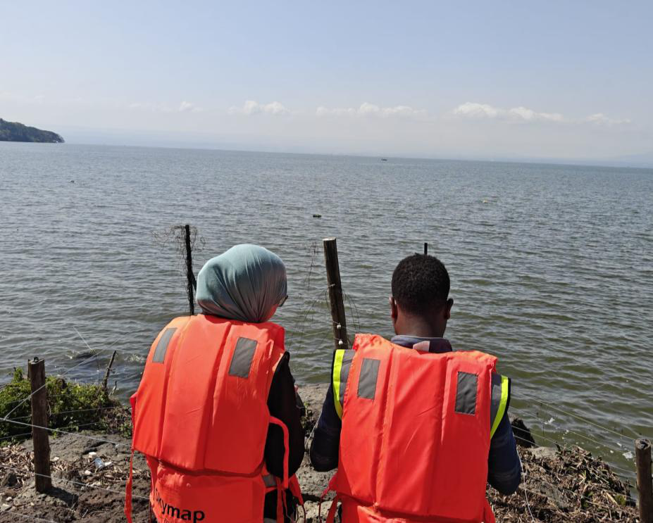
Ground control, sonar measurements and coordinated processing were combined to provide engineering-ready topographic and bathymetric information.
The team reviewed the survey area, site conditions and requirements for the proposed jetty to plan land and water-based data capture.
A CHCNAV multi-constellation GNSS receiver, used with the MUYA CORS network, captured shoreline topography and relevant terrain features.
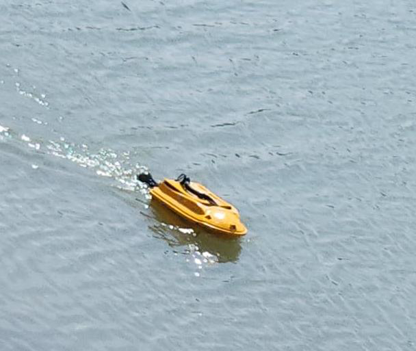
A calibrated Chirp single-beam echo sounder on a remote-controlled survey boat recorded depth measurements along planned survey lines, synchronized with GNSS positions.
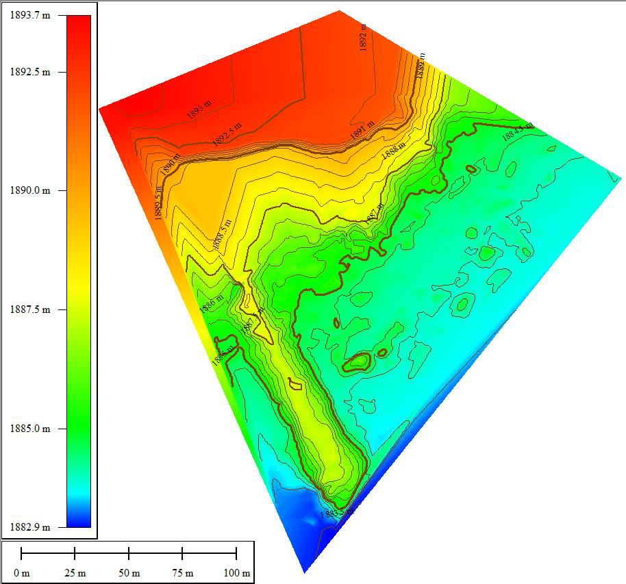
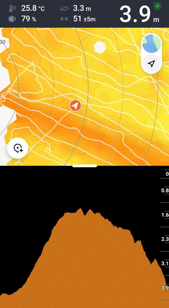
After field acquisition, the ground survey points and sonar depth records were cleaned, checked and compiled into a unified geospatial dataset. Time, position and depth information from the boat was synchronised to support spatially consistent bathymetric mapping.
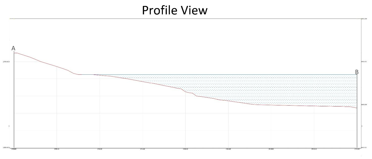
The processing team reconciled the reference levels for the land and water datasets to establish a continuous elevation model across the shoreline transition. This integrated digital elevation model (DEM) represents both the lakefront terrain and the lakebed in a common engineering context.
Combining the two datasets helps designers understand the relationship between the proposed jetty, the shore profile and the underwater ground conditions.
The final survey products translated the field measurements into spatial information that can be interpreted and used by design teams.
A combined map of the land and lakebed, presenting the surveyed area in one consistent layout.
A profile extracted from the integrated model to support assessment of the proposed jetty alignment.
Digital mapping and PDF plots prepared for use in common CAD-based engineering workflows.
A continuous representation of shoreline topography and underwater terrain for engineering interpretation.
Terrestrial survey points tied to the project’s coordinate reference approach for a reliable landward baseline.
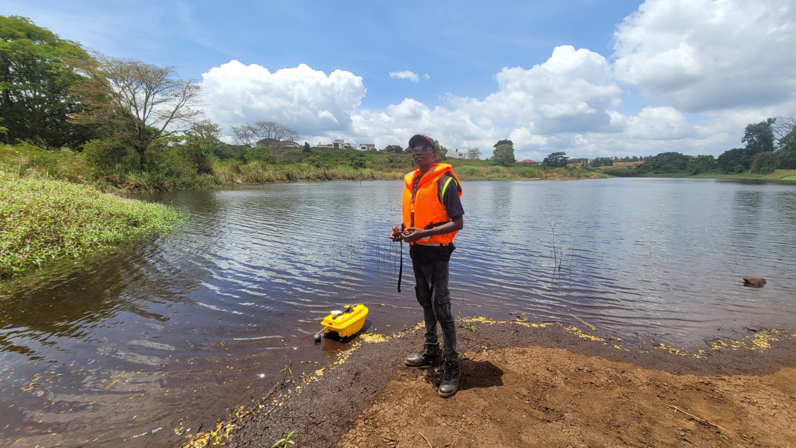
The remote-controlled boat allowed sonar data collection without a surveyor needing to operate the boat directly.
Review the jetty design needs, access and survey limits.
Measure shoreline terrain with GNSS RTK and lake depths with sonar.
Process the terrestrial and hydrographic datasets into one elevation model.
Produce maps, profiles and digital files to support engineering interpretation.
Skymap Africa combines hydrographic survey methods and land surveying to provide site data for lakefront developments, dams, reservoirs and other water-related infrastructure.
A bathymetric survey measures underwater depths and represents the shape of a lakebed, riverbed, reservoir bed or other submerged terrain.
Combining both methods links the underwater terrain to the shoreline and surrounding ground, giving engineering teams a more complete site model for design.
The report describes a calibrated Chirp single-beam echo sounder, a remote-controlled survey boat, and a CHCNAV multi-constellation GNSS receiver used with the MUYA CORS network.
The integrated map, elevation model and longitudinal profile provide site information to support jetty engineering design. Final design decisions remain with the appointed engineering team.
Speak to Skymap Africa about bathymetric mapping, shoreline surveys and integrated engineering data.